
Conference presentations (~2026)
We have provided records of academic conferences attended by students from the Arikawa Laboratory.
We presented our research at the Asia Oceania Geosciences Society (AOGS) 23rd Annual Meeting (AOGS 2026).

2026/8/3-2026/8/6
Professor Arikawa and 11 students participated in AOGS, held at the Fukuoka International Congress Center in Hakata, Fukuoka Prefecture, and presented their research results.
【Oral Presentation】
1. Numerical Modeling of the 2022 Tonga Tsunami with Time-Dependent Forcing
Numerical Modeling of the 2022 Tonga Tsunami Using Time-Dependent Forcing
Authors: Tatsuhiko Tokuda and Taro Arikawa
This presentation reported numerical experiments on the 2022 Tonga eruption tsunami using time-dependent vertical velocity forcing and investigated how different eruption conditions affect near-field tsunami propagation and run-up. While a static water-displacement model was unable to sufficiently reproduce the large tsunami trace heights observed along the northwestern coast of Tongatapu Island, the results indicated that imposing time-dependent vertical velocity can generate a tsunami with momentum near the source and potentially reproduce inundation heights closer to the observations. In addition, conditions involving multiple eruptions produced results that were more consistent with the tsunami characteristics observed in the field than those involving a single eruption.
During the Q&A session, questions were raised regarding the differences between the static water-displacement model and the time-dependent forcing approach, as well as the physical validity of the vertical velocities prescribed in the simulations. Through these discussions, we recognized again that evaluating source models for volcanic tsunamis requires not only reproducing observed inundation heights but also examining their relationships with eruption magnitude, eruption duration, and the energy and momentum introduced into the tsunami source. In future work, we aim to clarify the relationships among eruption area, water depth, eruption magnitude, and vertical velocity, while also considering other generation mechanisms such as caldera formation, in order to develop analytical methods that can more appropriately represent the generation and propagation processes of volcanic tsunamis.

2. Effect of Virtual Reality Based Tsunami Evacuation Training on Route Selection Behavior
Effects of VR-Based Tsunami Evacuation Training on Evacuation Route Selection Behavior
Authors: Reina Naito and Taro Arikawa
This presentation reported on the effects of VR-based tsunami evacuation training on route selection behavior during evacuation in an actual urban environment. Conventional tsunami evacuation drills are effective in promoting appropriate evacuation behavior; however, they are subject to constraints related to implementation time, location, and training methods. In contrast, VR-based evacuation training is less restricted by time and location and allows evacuation exercises to be conducted under various conditions that are difficult to reproduce in the real world, such as nighttime or rainy weather. In this study, both conventional on-site evacuation training and VR-based evacuation training were conducted to examine how each type of training influences evacuation route selection in a real environment. The results suggested that evacuation route memory and route selection may be influenced not only by training experience but also by characteristics of the surrounding environment, such as topography and road conditions, which was consistent with findings from previous studies. During the discussion following the presentation, we received valuable comments and insights regarding the research methodology, interpretation of the results, and future directions. Based on the knowledge obtained from this study, we will continue our research on tsunami evacuation training using VR.

3. A Spatiotemporal Comparison of Numerical and Machine-Learning-Based Weather Models for Wind-Wave Forecasting
Comparison of the Spatiotemporal Characteristics of Numerical Weather Prediction and MLWP Models for Wave Forecasting
Authors: Fuki Ogawa, Tomoki Shirai, Masafumi Tanaka, Yurie Itagaki, Taro Arikawa, and Tomoya Shibayama
This study quantitatively evaluated the accuracy of wave forecasts using AI-based weather models, which have recently been developed by various organizations, and compared the characteristics of the different models. The results showed that higher accuracy in forecasting offshore winds, which serve as the forcing for wave simulations, does not necessarily lead directly to higher wave forecast accuracy. Since the simulations in this study mainly focused on the winter season, questions were raised during the Q&A session regarding reproducibility in other seasons, highlighting the applicability of the models to extreme events such as typhoons as an important topic for future research. Based on the knowledge obtained regarding the characteristics of each model, we aim to develop a more accurate hybrid forecasting method that combines numerical weather prediction models with AI-based weather models.

4. Effects of Gap Geometry and Installation Angle on Permeability Characteristics of Flap-Gate
Effects of Gap Geometry and Installation Angle on the Permeability Characteristics of a Flap-Gate-Type Movable Breakwater
Authors: Tatsumitsu Harada, Tomoki Shirai, Kaito Hidano, Fumiaki Kakizuka, Kyoichi Nakaho, and Taro Arikawa
This presentation examined the flow passing through the gaps around the gate of a seabed-mounted flap-gate-type movable breakwater when the gate operates in an inclined position, resulting in water entering the harbor. The research involved conducting hydraulic model experiments that reproduced the inclined gate and surrounding gaps, proposing a flow-rate model based on the experimental results, and validating simulations incorporating the proposed flow-rate model. During the Q&A session, we were asked what would happen if a tsunami overtopped the structure. I briefly explained that, even for a large tsunami, the gate would remain in an upright position during the incoming wave. Professor Arikawa further explained that the structure is fundamentally designed to prevent overtopping and that, even if overtopping occurs, it is designed to maintain structural resilience. In particular, I learned that, especially since the Great East Japan Earthquake, perceptions in other countries regarding the durability and resilience of breakwaters may differ from what I had previously assumed. This was a very valuable experience. In future work, we will continue developing the model for application to large-scale simulations.

5.Experimental and Numerical Analysis of the Stability of Gabions as Armoring Units for Composite Breakwater Mounds
Experimental and Numerical Analysis of the Wave-Induced Stability of Gabions as Armoring Units for Composite Breakwater Mounds
Authors: Kuya Masuda, Ichiro Matsumura, Toru Aota, Shigeru Sakamoto, Takeharu Konami, Hideto Okido, Kiyotsugu Urai, Yota Enomoto, and Taro Arikawa
This presentation reported the results of hydraulic model experiments and numerical analyses investigating the wave-induced stability of gabions used as armoring units for composite breakwater mounds. The experiments confirmed that when gabions were placed closely together, uplift and overturning occurred near the shoulder of the mound, while connecting the gabions around the mound shoulder reduced sliding damage. In the numerical analysis, uplift and overturning were evaluated using the overturning moment induced by wave forces, and the initial locations of sliding damage were approximately reproduced using the Isbash formula.
In future work, further investigations under conditions that more closely represent actual marine environments, including irregular waves, will be necessary for practical field applications.

6.Hindcast Accuracy of Storm Surge, Tide, and River Water Levels: A Case Study of Typhoon Lan (2017)
Assessment of the Hindcast Accuracy of Storm Surge, Tide, and River Water Levels During Typhoon Lan (2017)
Authors: Fumina Matsuno, Tomoki Shirai, Tatsumitsu Harada, and Taro Arikawa
This presentation reported on the effects of different approaches to incorporating tides on the accuracy of simulated water levels under combined tide, storm surge, and river-flow conditions. With climate change, there is growing concern about the increasing risk associated with the combined effects of storm surges and river flows. However, methods for comprehensively incorporating these multiple factors into numerical simulations have not yet been fully established, and knowledge regarding their reproduction accuracy remains limited. In this study, we compared the accuracy of simulated water levels between two cases: one in which tidal water levels were prescribed as boundary conditions and tidal dynamics were represented within the model, and another in which astronomical tides were linearly added to storm-surge residuals calculated without explicitly including tides. The results showed that both cases tended to underestimate observed water levels around the storm-surge peak. In addition, the differences in reproduction accuracy between the two tidal approaches varied depending on the meteorological forcing used. When tides are represented within the computational model, the accuracy of tidal reproduction directly affects the simulation results; therefore, careful attention must be paid to the model's ability to reproduce tidal dynamics. Future work will focus on improving tidal reproduction accuracy and further investigating methods for incorporating river flow, as well as the effects of waves, which may be one factor contributing to the observed underestimation.

7.Evaluation of the Effectiveness and Applicability of Stereo Matching for Sea Surface Measurement
Evaluation of the Effectiveness and Applicability of Stereo Matching for Sea Surface Measurement
Authors: Rinako Maruyama, Tomoki Shirai, and Taro Arikawa
This presentation reported on the field applicability of WASS, a sea-surface measurement method using ground-based stereo cameras. At present, wave gauges and LiDAR are commonly used for coastal wave observations, but they have limitations in terms of observation coverage and operation. Therefore, this study focused on WASS, which can reconstruct the three-dimensional sea-surface geometry from video images captured by commercially available cameras. Videos were acquired in the field using different focal lengths and shooting conditions, and the feasibility of the processing and the resulting reconstructions were compared. The results showed that setting a region of interest (ROI) to restrict the analysis area to the sea surface by excluding the sky, land areas, structures, and other irrelevant regions significantly improved both the plane-estimation success rate and the valid triangulation rate. It was also confirmed that the processing results may vary depending on the focal length and field and installation conditions. A comparison with LiDAR showed a similar range of water-surface fluctuations; however, because the observation times and locations were not strictly synchronized, a quantitative accuracy assessment could not yet be conducted. In future work, synchronized observations using WASS and wave gauges will be conducted to compare data obtained at the same time and location, evaluate measurement accuracy, and explore applications to long-term coastal monitoring.

【Poster Presentation】
1.Stochastic Fault Modeling, PTHA, and ML-Based Prediction for Tsunami Hazard in the Marmara Sea
Stochastic Fault Modeling, PTHA, and Machine-Learning-Based Prediction for Tsunami Hazard in the Marmara Sea
Authors: Tian Lunpu, Tatsuhiko Tokuda, Tomoya Kurihara, and Taro Arikawa
This study evaluated tsunami hazards in the Marmara Sea by combining stochastic fault modeling with numerical tsunami simulations. Based on regional fault characteristics and empirical scaling relationships, approximately 100 heterogeneous slip-distribution scenarios were generated, and tsunami propagation and inundation simulations were conducted using JAGURS. The resulting simulations were used to evaluate the spatial variability of coastal tsunami heights and inundation characteristics associated with source uncertainty. Future work will focus on the relationship between water-level information obtained at observation points and inundation results, with the aim of developing a machine-learning-based method for rapid prediction of tsunami impacts.

2.A Study on Reproducing Debris Motion Experiments Using STOC-DM
A Study on Reproducing Debris Motion Experiments Using STOC-DM
Authors: Jiayu Feng, Yota Enomoto, and Taro Arikawa
This presentation reported research on improving the contact and collision models in STOC-DM for simulating the movement and dispersion behavior of groups of tsunami debris. In this study, the hydraulic experiments conducted by Park et al. (2021) were reproduced, and the definitions of contact states and collision detection were reformulated so that collisions between debris objects could also be evaluated while they were in contact with the ground.
The analysis showed that, even without introducing random motion, collisions between individual debris objects could trigger dispersion throughout the debris group. During the discussion following the presentation, this behavior was considered not only in terms of stochastic variability, but also from the perspectives of multi-body interactions arising from successive contacts and collisions among multiple debris objects, as well as the influence of differences in initial conditions on their subsequent behavior.
Future work will focus on developing a model that more appropriately represents interactions between debris and the surrounding flow field, while further investigating the dispersion mechanisms of debris groups governed by the combined effects of collision, contact, and flotation.

3.Parameter Study of Bottom Manning’s Roughness Coefficient in Submarine Landslide Tsunami Experiment Using a Two-layer Model
Parameter Study of the Bottom Manning’s Roughness Coefficient in a Submarine Landslide Tsunami Experiment Using a Two-Layer Model
Authors: Kaito Suzuki, Taro Arikawa, Yota Enomoto, and Tomoya Kurihara
In this study, numerical simulations using a two-layer flow model were conducted to reproduce hydraulic model experiments of submarine landslide-generated tsunamis, and the effects of the bottom Manning’s roughness coefficient in the momentum equation of the lower layer on tsunami wavelength and landslide-mass motion were evaluated.
The results showed that the maximum negative water-level fluctuation generally agreed with the experimental values, whereas the motion of the landslide mass was underestimated. In addition, variations in the parameter had only limited effects on water-level fluctuations and wavelength, and water-level fluctuations were observed even when the landslide mass did not move sufficiently. These results indicate that improving the reproducibility of landslide-mass motion, in addition to reproducing the tsunami itself, remains an important issue for future research.

4.Fundamental Study of Regularization Parameters in Wave Source Estimation Methods Without Assuming Fault Parameters
Fundamental Study of Regularization Parameters in Wave Source Estimation Methods Without Assuming Fault Parameters
Authors: Kazuki Tsuganezawa, Tatsuhiko Tokuda, and Taro Arikawa
In this study, a sensitivity analysis was conducted to examine how parameters that strongly affect the accuracy of wave-source estimation using the adjoint method, which has recently attracted considerable attention, vary depending on the size of the wave-source estimation domain. The results suggested that, under large-area wave-source estimation conditions, conventional parameter-search methods may not always provide robust solutions.
During the Q&A session, questions were raised regarding the duration of the observed waveforms used for wave-source estimation and possible approaches to addressing the issues identified through this study.
Future work will focus on improving and evaluating the accuracy of wave-source estimation under large-area conditions.

Research presentations were given at the 51st Ocean Development Symposium. In addition, the Ocean Development Paper Encouragement Award was received.
2026/7/1-2026/7/3
Professor Arikawa and two students participated in the Ocean Development Symposium, held at Kumamoto-jo Hall in Kumamoto City, Kumamoto Prefecture, and presented their research results.
1. Wave-Induced Stability of Gabions as Armoring Units for Composite Breakwater Mounds and Applicability of a Numerical Wave Flume
Authors: Kuya Masuda, Ichiro Matsumura, Toru Aota, Shigeru Sakamoto, Takeharu Konami, Hideto Okido, Kiyotsugu Urai, and Taro Arikawa
[Comments (Masuda)]
At this Ocean Development Symposium, I had the opportunity to present our evaluation of the wave-induced stability of gabions through hydraulic model experiments and the applicability of numerical analysis methods to wave-resistance design. In addition, this paper received the Ocean Development Paper Encouragement Award.
This award was made possible through the extensive guidance and support of Professor Arikawa, senior members of the laboratory, and members of the Reef Mat Industry Association. I would like to take this opportunity to express my sincere gratitude once again.
The presentation also provided me with a highly valuable opportunity to consider how to communicate my research in a concise and easy-to-understand manner. I hope to make use of this experience in future seminars and research activities by preparing presentations with greater attention to how effectively the content is conveyed to the audience.
-
Study on a Numerical Simulation Method for the Super Well Point Method
Authors: Kosuke Nobusawa, Takayuki Yamane, Shigeyoshi Takahashi, Yota Enomoto, and Taro Arikawa
[Presentation Content]
Drainage methods are essential for underground construction in ground with a high groundwater level. In particular, the Super Well Point (SWP) method achieves high drainage efficiency by applying negative pressure inside wells. However, the design of pumping rates and well arrangements currently relies heavily on pumping tests, creating a need for a numerical method capable of providing prior evaluation. In this study, a three-dimensional seepage-flow analysis model was developed, and its ability to reproduce groundwater-level drawdown was examined through application to an actual construction project. A fundamental investigation focusing on cavitation under negative-pressure conditions was also conducted. The results showed that groundwater-level drawdown corresponding to differences in drainage capacity and hydraulic conductivity could be reproduced, suggesting the applicability of the proposed method at field scale. Furthermore, fundamental numerical simulations reproducing flow between soil particles confirmed the formation of localized negative-pressure regions and the occurrence of cavitation, with the vapor fraction under the present computational conditions ranging from approximately 0 to 20%.
3. Study on the Wave-Induced Stability of Gabions Used as Scour Protection around the Foundations of Monopile Offshore Wind Turbines
Authors: Hiroki Kojima, Masao Kikuchi, Takeshi Katayama, Yota Enomoto, and Taro Arikawa
[Presentation Content]
In Japan, bag-type materials are commonly used as scour protection around the foundations of monopile offshore wind turbines. On the other hand, the applicability of gabions, which can more easily provide sufficient weight to accommodate a wide range of marine conditions, has also been investigated. However, their stability against wave action has not yet been sufficiently clarified. Therefore, this study primarily used hydraulic model experiments to investigate the wave-induced stability of gabions. The results showed sliding damage to the gabions and indicated that stability decreases when gaps are present between adjacent gabions. Based on the experimental results, the wave height at which the average sliding displacement of the gabions became equal to the minimum particle diameter of the crushed stone in the filter layer was estimated, and a stability number was calculated by substituting the obtained wave height into the Hudson formula. Numerical simulations showed increased near-bed flow velocities within the gaps between gabions, suggesting the possibility of filter-layer material being washed out due to locally increased hydraulic gradients.


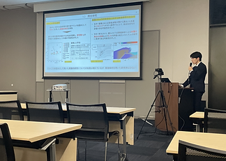
Participation in the 72nd Coastal Engineering Lecture Meeting
2026/5/17-2026/5/22
Professor Arikawa and five students participated in ICCE, held in Texas, USA, and presented their research results.
【Oral Presentations】
1. NUMERICAL MODELING OF THE 2022 TONGA VOLCANIC TSUNAMI USING A TIME-DEPENDENT VERTICAL FORCING APPROACH
Authors: Tatsuhiko Tokuda and Taro Arikawa
Volcanic tsunamis are among the most destructive yet least understood natural hazards. Unlike earthquake-generated tsunamis, which are typically caused by seafloor displacement associated with fault movement, volcanic tsunamis can be generated by a wide range of mechanisms, including caldera collapse, pyroclastic flows, submarine landslides, lava-dome collapse, and explosive eruptions. The 1883 Krakatau eruption dramatically demonstrated their destructive potential, producing tsunami run-up heights exceeding 40 m and causing tens of thousands of fatalities. On January 15, 2022, the Hunga Tonga–Hunga Haʻapai (HTHH) submarine volcano produced one of the most powerful eruptions in recent history. The eruption generated atmospheric shock waves that traveled around the globe and produced tsunamis observed throughout the Pacific Ocean. In Japan, the United States, and South America, far-field tsunami amplitudes of approximately 1 m were observed. These signals are thought to have been associated with atmospheric Lamb waves and gravity waves that efficiently coupled with the ocean. In contrast, the near-field tsunami that struck Tonga caused much more severe damage, with run-up heights exceeding 10 m and extensive inundation on Tongatapu Island. The physical mechanism responsible for this near-field tsunami remains uncertain because conventional models based on static initial sea-surface displacement have not consistently reproduced the observed inundation extent and run-up heights. This highlights the potential importance of dynamic processes. Eruption-induced vertical water motion, rapid crater collapse, and multiple eruptive pulses have been suggested as possible contributing mechanisms. Laboratory experiments and recent numerical studies have suggested that even relatively modest vertical forcing at the eruption vent can generate disproportionately large tsunamis. To address these limitations, this study introduces a time-dependent vertical forcing model within a three-dimensional numerical framework and couples it with a two-dimensional propagation model to evaluate whether dynamic forcing can more appropriately reproduce the observed tsunami characteristics.
-
Evaluating Virtual Reality as a Tool for Tsunami Evacuation Training
Authors: Reina Naito and Taro Arikawa
Tsunami evacuation training is known to reduce evacuation delays and lower the risk of drowning. However, conventional training is limited by constraints related to time, location, and available scenarios, and participation rates are often low. Although virtual reality (VR) has increasingly been applied worldwide to disaster education and evacuation training, its application specifically to tsunami scenarios remains limited. In this study, a VR-based tsunami evacuation training system was developed, and its effectiveness was evaluated by comparing it with conventional on-site training and a case with no prior training. Participants were divided into three groups: VR training, on-site training, and no training. The VR environment was created using a three-dimensional model of the study area constructed through photogrammetry. Participants completed the VR training using a head-mounted display and controllers. On the following day, all participants took part in an evacuation simulation, and their performance was evaluated based on the correct selection of the designated evacuation site and evacuation route. The results showed that even a single VR training session improved the rate of correct responses for both evacuation-site and evacuation-route selection compared with no training. After three VR training sessions, performance was comparable to that achieved through on-site training. Notably, the improvement produced by a single VR session was greater than the remaining difference between one VR session and on-site training, suggesting that even a single experience can promote memory retention. These findings indicate that VR training may provide a flexible method that is not constrained by place or time and may contribute to reducing evacuation delays and associated risks. Future research should involve larger participant groups and examine the effects of factors such as road-network complexity and various disaster conditions on memory retention. -
Wind-blown sand behavior near the shoreline under the influence of moisture
Authors: Yuki Kasuya and Taro Arikawa
Sandy beaches serve multiple functions, and maintaining these functions is important. Katano et al. reported that, even in coastal areas where countermeasures against wind-blown sand had been implemented, shoreline retreat accelerated and wind-blown sand transport occurred from the swash-zone area. Furthermore, conventional transport equations used to describe wind-blown sand flux generally assume dry sand and do not account for moisture. In this study, experiments were conducted based on field observations. Coastal topography was reproduced using a cross section consisting of an inclined section connected to a horizontal section. Wet and dry slopes were created depending on whether water was supplied. Under dry conditions, the slope reduced the cross-sectional area of the airflow, and once the threshold friction velocity was exceeded, relatively uniform lowering of the sand surface began near the boundary between the slope and the horizontal section. When water was supplied, the wet region expanded due to capillary forces, reducing the airflow cross-sectional area and increasing wind speed. For comparison, the same cross-sectional geometry was reproduced using a wooden board without water injection. The experiments revealed clear differences in erosion patterns. Under dry conditions, lowering of the sand surface was relatively uniform. Under wet conditions, the wet region suppressed wind-blown sand transport because of increased surface cohesion, whereas rapid scour occurred in the adjacent non-wet region near the boundary between the slope and the horizontal surface. Moisture in the sand may therefore promote lowering of the sand surface near the shoreline and accelerate shoreline retreat. Clarifying the mechanisms of wind-blown sand transport near the shoreline under wet conditions is therefore essential for improving the accuracy of coastal morphology predictions and deepening the fundamental understanding of these processes.


【Poster Presentations】
-
DEVELOPMENT OF A COUPLED FVM-MPM ANALYSIS MODEL FOR HIGH-VELOCITY SEEPAGE FLOW IN POROUS MEDIA
Authors: Yota Enomoto and Taro Arikawa
A strongly coupled finite-volume method–material point method (FVM–MPM) framework is proposed for high-velocity seepage flow through highly deformable permeable granular media. The fluid phase is solved using CADMAS-SURF/3D-2F (CS2F), an incompressible Navier–Stokes volume-of-fluid solver incorporating resistance terms for porous media. The bulk resistance combines Darcy–Brinkman resistance with a Dupuit–Forchheimer contribution, while the evolution of porosity and its time derivative are incorporated into the continuity and VOF advection equations to represent changes in void ratio induced by deformation of the solid skeleton. The solid skeleton is discretized using an explicit MPM, with grid–particle transfer and contact treatment handled without remeshing. A pressure-projection step derived using a potential function produces a Helmholtz problem consistent with the SMAC algorithm and enables strong coupling between CS2F and MPM at each time step without staggered iteration. The formulation was evaluated using standard porous-flow benchmarks—including pressure loss through a packed column, rapid acceleration, and converging–diverging flow passages—as well as permeable mound configurations representative of riprap and rubble-mound breakwaters. Comparisons were conducted with single-point and double-point MPM approximations, a CS2F model considering only linear drag, and a weakly coupled CS2F–MPM variant. The results showed that (i) inclusion of the time derivative of porosity stabilizes the pressure solution in highly permeable soils, (ii) the Forchheimer correction improves accuracy in inertia-dominated regimes, and (iii) strong coupling captures feedback between seepage and deformation that cannot be represented using a conventional u–p formulation. The proposed framework clarifies the applicability limits of Darcy-based approaches and provides a practical and scalable tool for coastal-structure problems involving the coexistence of overtopping and internal erosion, even when particle-scale transport is not explicitly resolved. Benchmark data and scripts are also provided. -
VALIDATING A TSUNAMI DETECTION METHOD BASED ON SWASH-ZONE MONITORING WITH CCTV CAMERAS
Authors: Tomoki Shirai and Taro Arikawa
In recent years, monitoring using low-cost coastal CCTV cameras has attracted attention as a promising approach for complementing expensive offshore observation networks. This study aims to validate the effectiveness of an image-analysis method that automatically extracts high-frequency shoreline fluctuations from CCTV footage by applying it to actual tsunami events. The method combines tracking of run-up waves based on luminance variance within short temporal windows with a color-based land–water mask, enabling stable monitoring of run-up height in the high-frequency and noisy range of 1–2 Hz. The method was applied to footage from the 2024 Noto Peninsula earthquake tsunami and the 2025 Kamchatka Peninsula earthquake tsunami. The results showed that the shoreline could generally be tracked under various geomorphological conditions, including sandy beaches, gravel beaches, and breakwaters, as well as under a variety of daytime weather and lighting conditions from morning to evening, including clear, cloudy, and rainy weather. Periodic components extracted from the tsunami run-up-height time series exhibited reasonable amplitudes and phases compared with numerical simulations and offshore observations. Comparison with conventional methods based on 10-minute time-averaged images, which are commonly used for shoreline-detection tasks, also demonstrated the importance of high-frequency monitoring such as that proposed in this study for accurately estimating tsunami amplitudes. Although the validation was based on relatively small tsunami events, the results support the effectiveness of the proposed method for the events considered and highlight its potential to improve future tsunami-monitoring capabilities. Future work will examine its applicability to larger tsunamis, particularly those involving wave breaking or large angles of incidence relative to the shoreline.